CALIFORNIA
Death Valley Junction


Delight’s Hot Springs Resort, Tecopa

Delight’s Hot Springs Resort is where John Huston whisked his daughter/granddaughter when things heated up in Chinatown.
Or so it seems. This Death Valley resort has all the elements of a perfect film noir hideaway: discreet, private, remote in the extreme. Eerily quiet. Blinds on the windows creating high-contrast shadows.
Elias Delight bought the land in 1950, paying with $2,000 in Civil War script that his grandfather happened to have saved after the war. The land had been set aside for veterans after the Civil War, and could only be bought with federal coupons.

Every day the ill-fated girl surveys the desert from her locked front porch. A minder drops by once a day to bring food and movie magazines. He says little, leaves quickly.
Her cottage is cozy enough. She smells sulfur each time she enters, but she soon becomes accustomed to it. The real problem is the quiet, the isolation, after the hum and honk of the city.


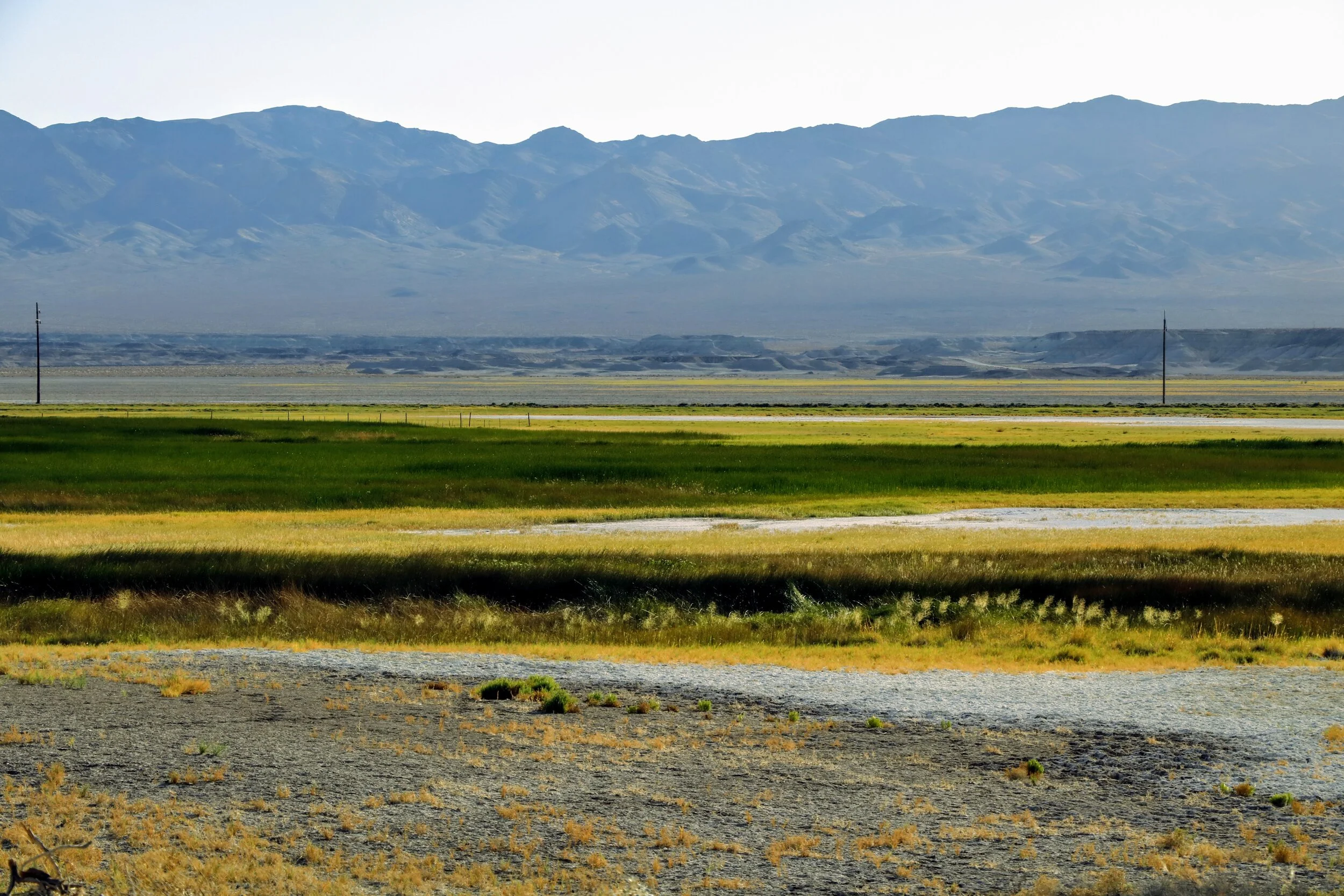
The desert sun sets over the salt flats.

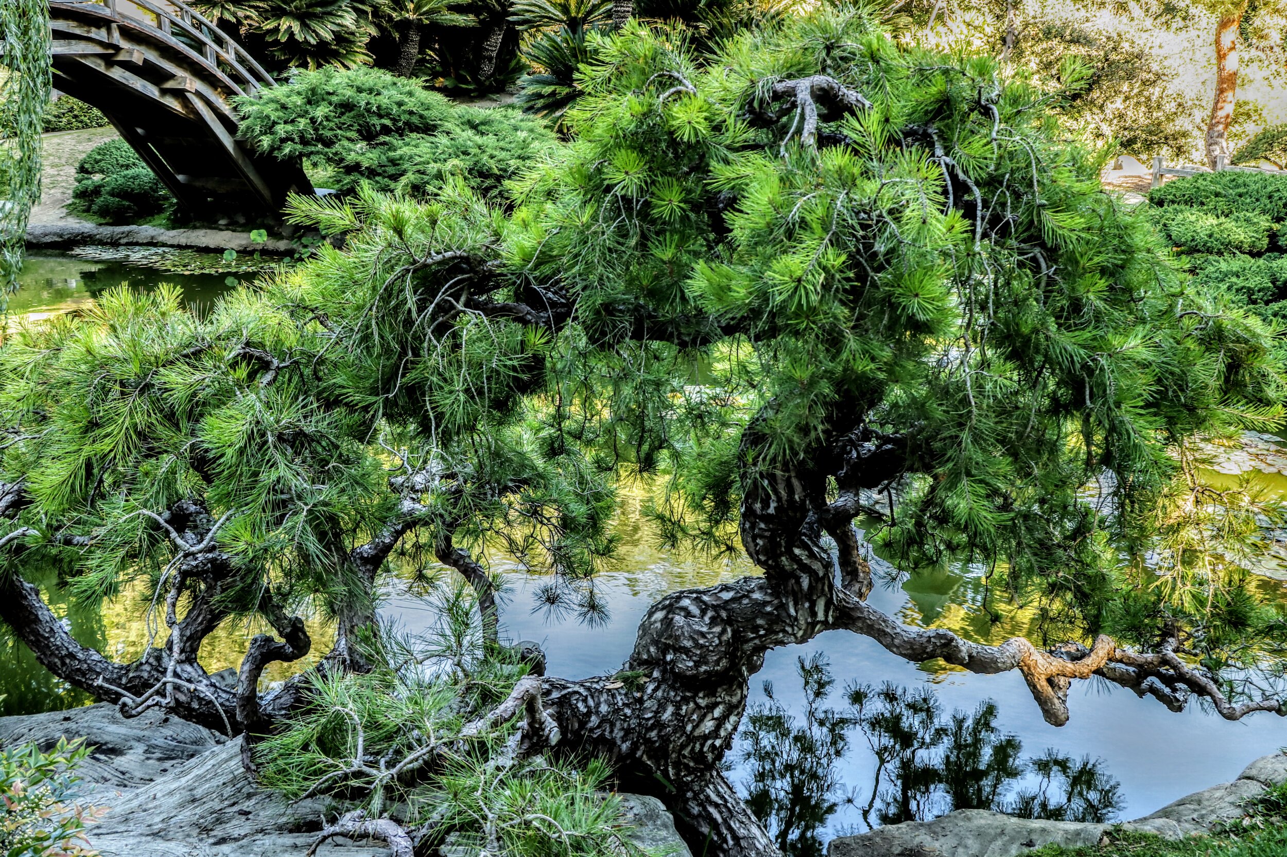
Even in this inhospitable landscape: green life!

The caretaker’s shed is patrolled by an aged, stone-deaf chihuahua.

I drop into the office to register, as instructed.
“Welcome to your new addiction!” Jessica, the woman at the desk, says.
Bleary-eyed from a long drive through Death Valley, I say nothing.
“I mean that in a good way,” she adds quickly.

Remote, but guarded by wind angels. The fence separates the resort from Bureau of Land Management (BLM) land, owned by the American public.


There are several of these shrine/graves around the place. Pets, perhaps? Or something far more sinister?

Tecopa
The Shoshone and Paiute people wintered in the hot springs in Tecopa, which they called Yaga, where they hunted small game and gathered mesquite beans and other plants. Yaga was the largest settlement in the area with about 70 inhabitants when New Mexican horse trader Antonio Armijo visited in 1830. — chinaranch.com
“The main settlement of the Southern Paiute on the Amargosa was at Yaga, now Tecopa Hot Springs. With about 70 inhabitants (in 1830), this was the largest Indian village in the Death Valley— … and the first to be visited by white men, when New Mexican horse traders opened a trail to California in 1830. Unlike the Shoshone, the Southern Paiute relied more heavily on cultivated crops such as beans,corn, melons, squash, sunflowers, and grapes. … Horsemeat also became a regular part of their diet once New Mexican caravans began their annual trek to California, returning each spring with thousands of horses.” — Richard E. Lingenfelter, Death Valley & the Amargosa: A Land of Illusion, 1986.


Crane my neck as I might, I caught nary a whiff of a river that day.


The pakwinavi of Tecopa, Pahrump, Moqua, and Nogwa in the late 19th century was Tecopa (above). Lingenfelter writes, “Tecopa means ‘wildcat,’ but it was an inadequate description for so shrewd and skillful a negotiator as he.
White settlers, imagining his influence to be much wider than it was (and he did not discourage this notion, “plied him with gifts, including a favored stovepipe hat, and named a mining camp after him, all to win his aid and blessings in prospecting the surrounding country” Lingenfelter 22).
Tecopa’s son, known as Tecopa John, became pakwinavi after Tecopa’s death in 1905. John discovered therich Johnnie gold mine near Pahrump, though was never as politically influential as his father.

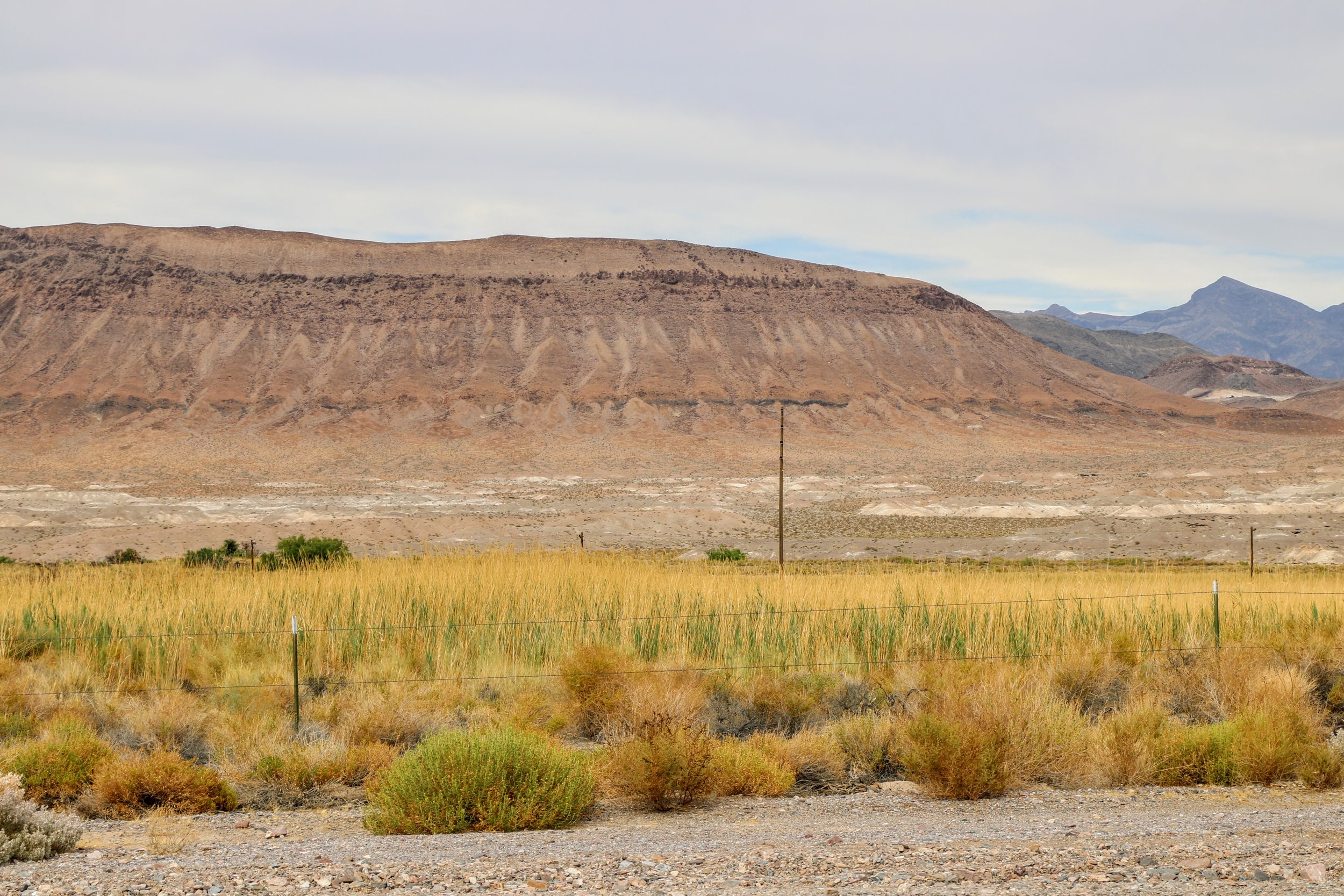
Death Valley is an ancient lake bed (Lake Manly) — which may or may not explain the otherworldly formations left high and dry here.

About 106 F that day, as I recall.
China Ranch


Aha! So that’s why they called it Lake Manly.

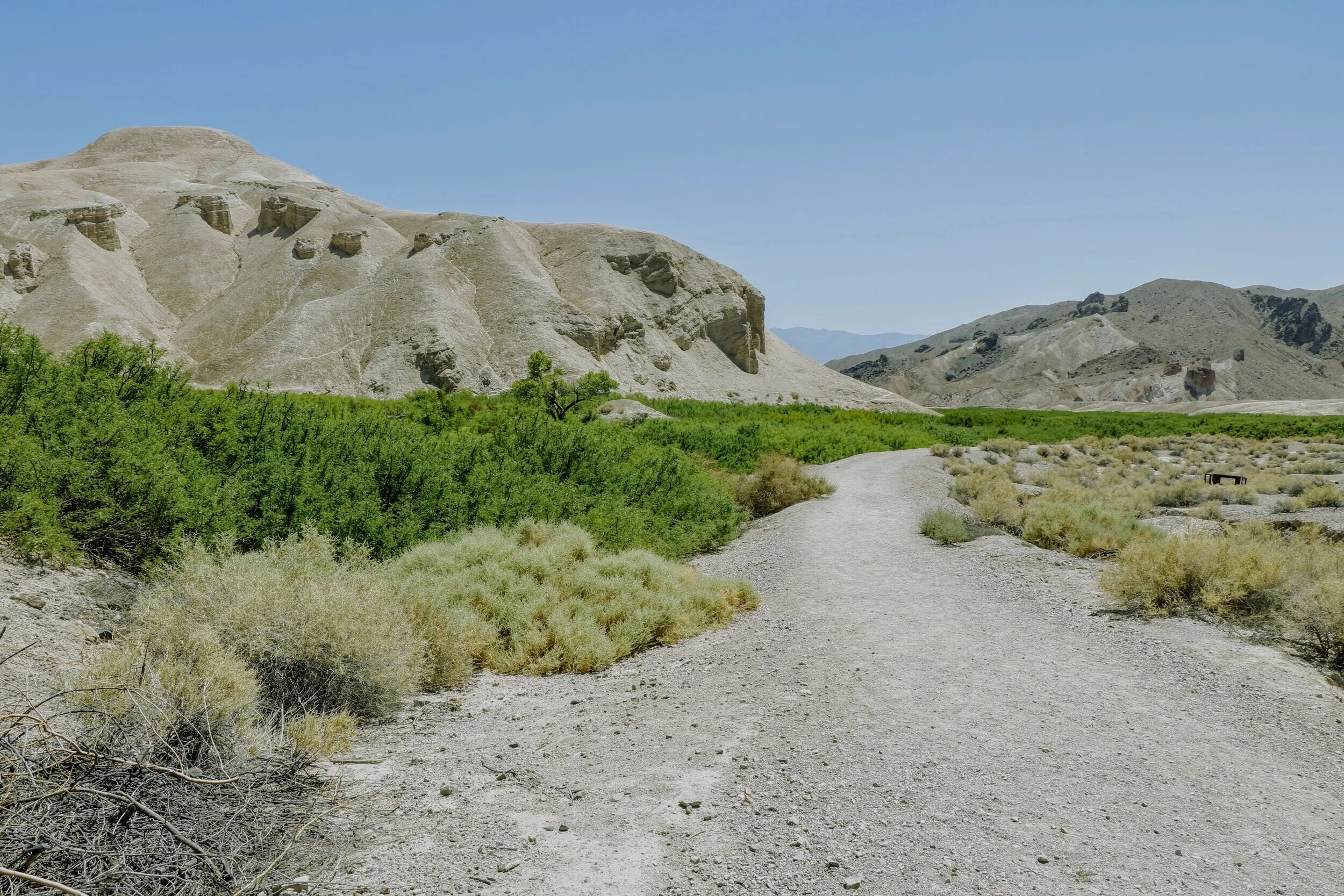
The 2-mile road to this odd farm is bizarre itself, with rock formations, and multiple types of rock, juxtaposed almost nonchalantly. The ranch originally provided mutton, beef, and produce to the Goldfield miners in the early 1900s (see more on Goldfield under “NEVADA”). The farm was started by a man named Ah Foo, known not charmingly then as “The Chinaman,” and his ranch as “Chinaman Ranch,” later shortened to China Ranch. Foo made major bucks on this venture — then disappeared under mysterious circumstances in 1907 (?).
His farm was then taken over by a man named Morrison (Foo’s murderer, perhaps?). This land has since grown figs, cattle, hogs, and alfalfa, all fed by the _____ Creek which runs through the canyon. when __ bought the land, by then returned to desert. ______ built a house there, and his wife, ________, ordered some date seeds from a catalog, thinking they might grow well there, and create stately rows along the driveway to the house. Well, they thrived, and long story short, the ranch became a date farm, now owned by the Charles Brown family from nearby Shoshone. It serves up several varieties of fresh dates, plus delicious date shakes; the gift shop sells desert rocks, woven goods, pottery, jewelry, tchotchkes, and other Death Valley-related merch.


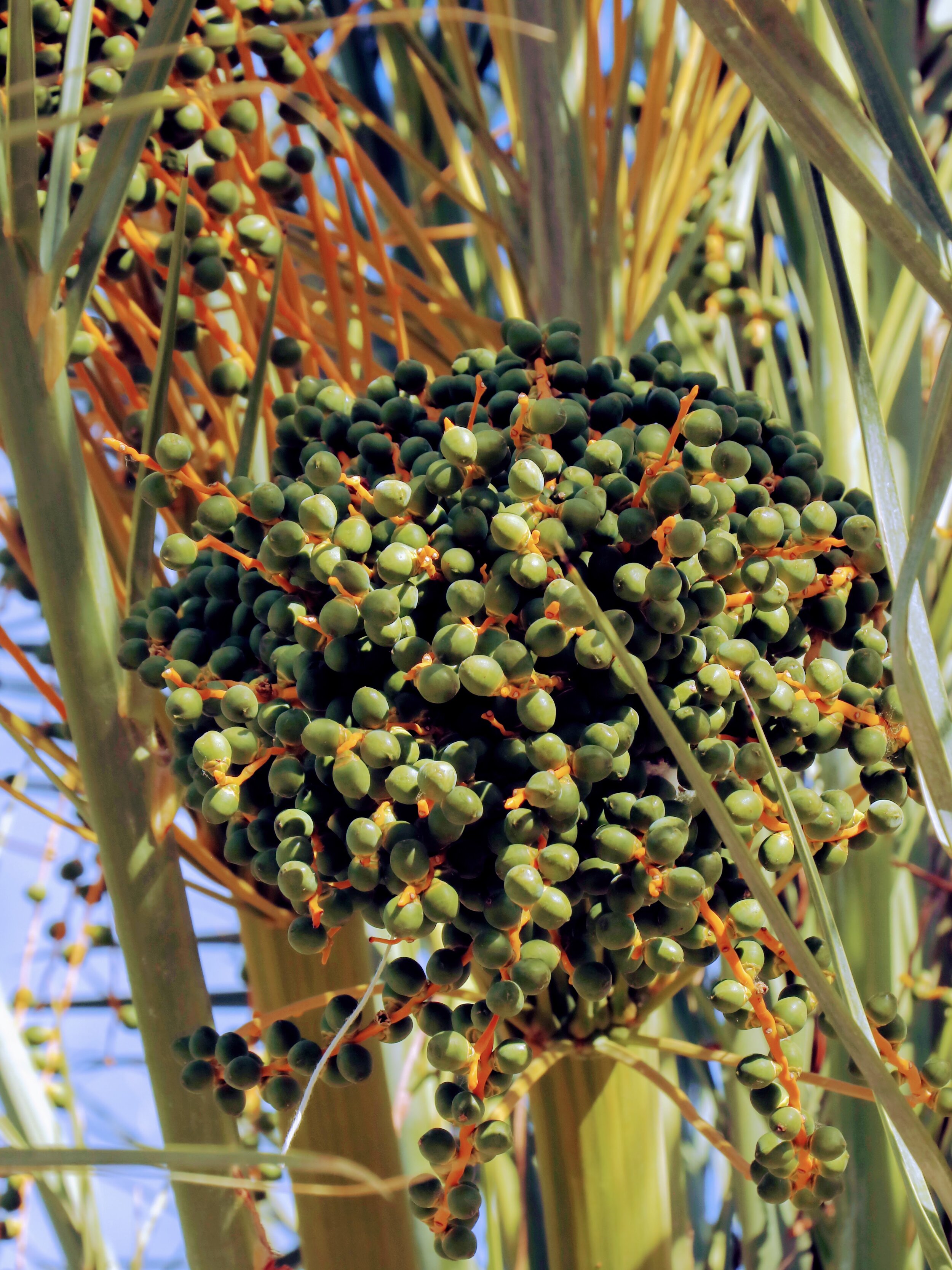
Top and above left: China Ranch date grove Left: China Grove Museum Above: Baby dates

Encouraged by the gift store manager, I hiked out into the valley in mid-afternoon, mid-June, for a "2-mile loop,” which turned into 4 or 5. I got back in deep distress from heat exhaustion — I’d stopped sweating, my eyesight got blurry — scary. And totally preventable. Should’ve taken more water, shouldn’t’ve gone out there alone (there was absolutely no one there) — alla that. Luckily for me, the landscape was so distinctive that I found my way back without too much trouble. Anyway, an incredible landscape. I’ll go back, but with at least a gallon of water and earlier in the day.


“Early hunters and gatherers were roaming the edges of Lake Manly by 10,000 B.C. Bone chips found indicate that they hunted large game, probably deer or big horn sheep. Shell beads indicate that they had contact with groups along the Pacific coast.
The Shoshone and Paiute Indians migrated into the great basin sometime after 1000 A.D. Nomadic hunters and gatherers, they undoubtedly used the various resources of the canyon for food and shelter.